Sixpenny Handley
|
Sixpenny Handley |
|
|
|
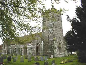
Handley a large village in the Hundred of its name, is 4 miles from the Wiltshire border, 5 miles NW of Cranborne and 10 miles NE of Blandford. The village was originally known as Handley or Handley St Mary. The use of the name Sixpenny Handley to describe the village and parish is fairly modern, being used as an alternative name by the middle of the 19th century. Handley is derived from the Old English hean "high" and leage "clearing". Sixpenny was added to distinguish the place from other Handleys, and refers to Sixpenny Handley Hundred, first mentioned in the 14th century as the hundred of "Sexpenne et Henle". The hundred took its name from this Handley and a place called Sixpenny, now a farm, in the south west of the parish of Fontmell Magna. Sixpenny was first recorded in 932 as Seaxpenn, and means "hill of the Saxons" (from Old English Seaxe and Brythonic penn). The Church of St Mary is of mainly Gothic architecture with an embattled square tower and a sturdy porch built in stone and of brick interior. It has a splendid wooden beamed roof, the font is of Early English 12th c with straight supports on each corner. The belfry contains 3 bells. It has been much added to in later years. |
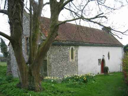
Handley includes the hamlets of Woodcutts, Newton, Deanland and Minchington with the Chapelry of Gussage St Andrew 3 miles SW now annexed from Handley. Sixpenny-Handley were anciently two separate Hundreds, revenues each year make Sixpenny the more important. It belonged with the chapel of St Andrew to the Abbess of Shaftesbury. About 1332 Sixpenny disappeared from the records. It reappeared in the 16th c added to Handley. After the Reformation it was sold to the Glyn family. The Ley family known as ALYE have a memorial plate in the church dating from 1625. Handley is one long street with the church at the top. Worbarrow Hill is famed for its celtic treasure here and can be seen in Farnham Museum. Two Wesleyan chapels were here and a National School was erected in 1851. Sheep farming was the main occupation but other trades were well covered. The population in 1861 was 1,203. Area covering 5,928 acres. A fire in the village in the 19th c made over 200 people homeless. Many donated sums of money to the homeless totalling approx £1000 at that time. |
|
Please include the words "OPC Sixpenny
Handley" in the subject line of your messages |
|
| Census |
1841 [Kim Parker] 1851 [Kim Parker] 1861ED16,ED17 [Kim Parker] 1871 1881 [Terry Smith] |
| Bishop's Transcripts |
Baptisms 1731-1770 Marriages 1732-1754 Burials 1731-1770 |
| Parish Registers |
Baptisms 1767-1812,
1813-1844,
1844-1880 Marriages 1754-1836, 1837-1880 Burials 1769-1812, 1813-1880 Chapelry of Gussage St Andrew Baptisms 1751-1920 Marriages 1751-1753 Burials 1775-1819 |
| Other Records |
Index of Wills for Sixpenny Handley
residents St Mary's Monumental Inscriptions index [Jan Hibberd] |
| Maps | The 1891 Ordnance Survey maps of the parish can be seen at the old-maps site, just enter 'Handley' under place search. |
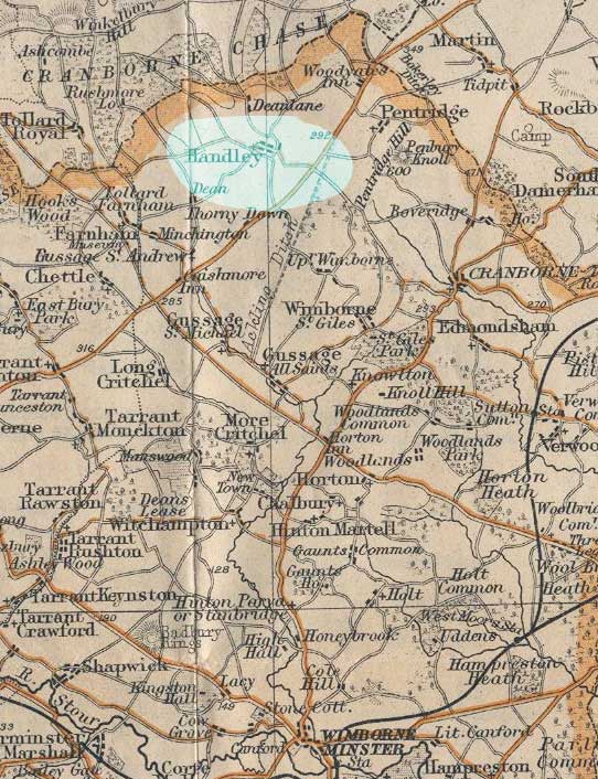 |
For modern
location maps visit:- Click on the thumb nail (left) for a 1920s map of the area. |
|
View Larger Map |
|
| Records held at the Dorset History Centre |
Registers Christenings 1767-1925. Marriages 1754-1963. Burials 1767-1976. |
| Registration District
(for the purpose of civil registration births, marriages & deaths) |
1 Jul 1837-31 Mar 1937: Wimborne [Handley] 1 Apr 1937-30 Jun 1956: Blandord 1 Jul 1956-31 Mar 1997: Poole 1 Apr 1997-17 Oct 2005: East Dorset |
|
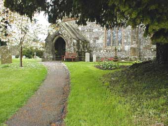
Entrance to the parish church with the war memorial © Anne Preston |
Chapel of St Andrew, courtesy of Peter Walker © |
Visitors to Dorset OPC
Copyright (c) 2025 Dorset OPC Project