Postcards of Dorchester - The Walks

All Cards are from the private postcard collection of Michael Russell OPC for Dorchester & Fordington
© Copyright Mr. M Russell FIPD All Rights Reserved

Most cards can be dated approximately from image ref numbers on the front or back of the card.
If you have other postcards showing different scenes from Dorchester's past please make contact via the email address on the front page.

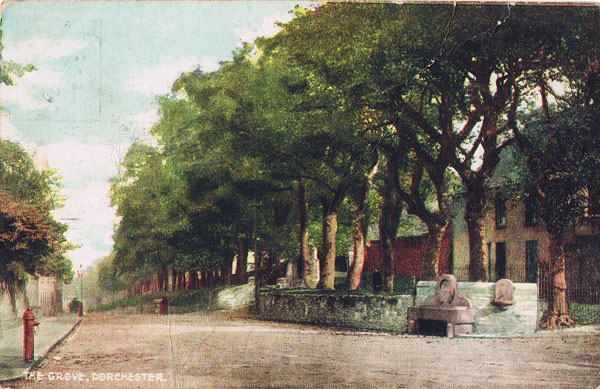
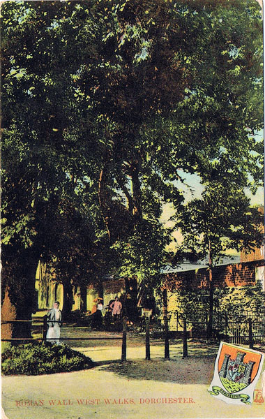
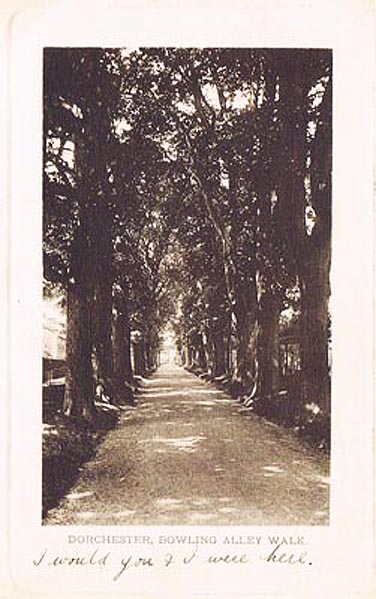
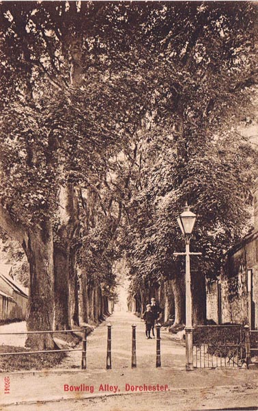
The Walks: On John Speed's Map of Dorchester dated 1611, nearly surrounding Dorchester, can be seen the remnants of the earthen works where the old Roman Wall was. Only one very small section survives today (see pictures) To the east the wall marked the boundary with the parish of Fordington where the Church of St George stands. To the North the wall followed the river with the parish of Frome Whitfield on the other side. The Romans did much to shape Dorchester for the old Roman Wall, even though largely demolished by 1611 as much of the stone had been robbed out for use in other buildings, left behind substantial earthen embankments. These were temporarily repaired during the Civil War in an inadequate attempt to fortify the town against the Kings Army. As far as I can see, from the limited amount of documentation available to me, the first part of the wall to be used as a way was 'Bowling Alley Walks' as there is reference in 1635 to "The inhabitants of Fordington, who have made of late a common trade way over the Bowling Alley with horses, carts and carriages".

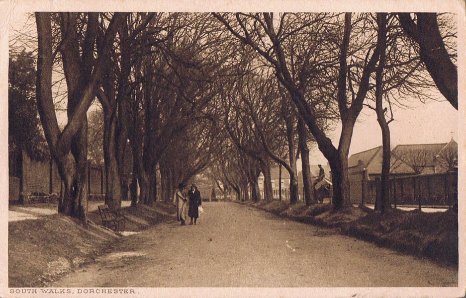
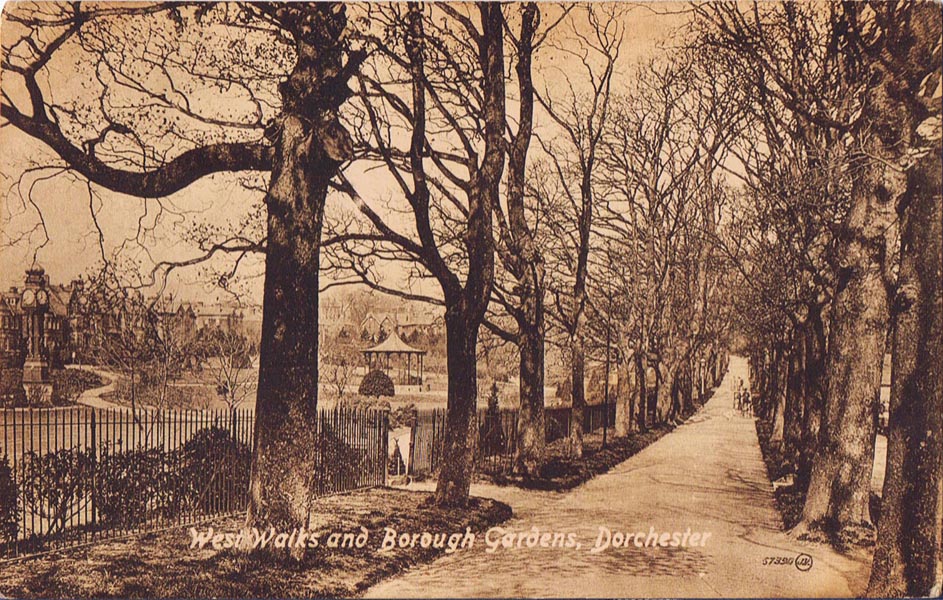
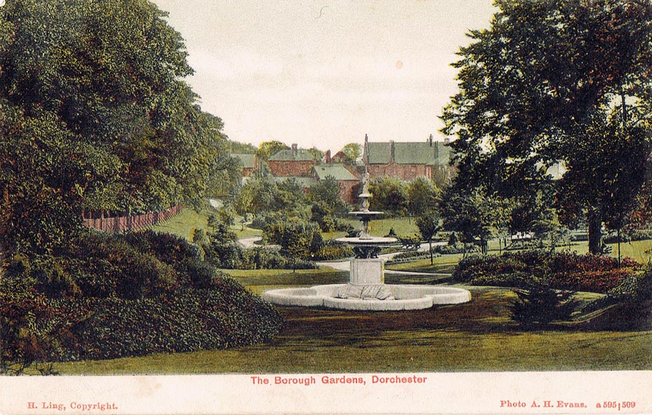
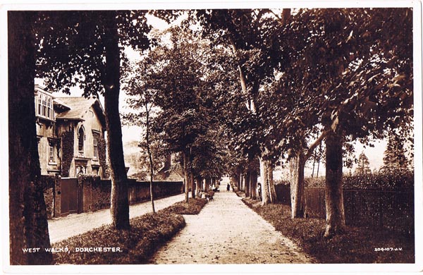
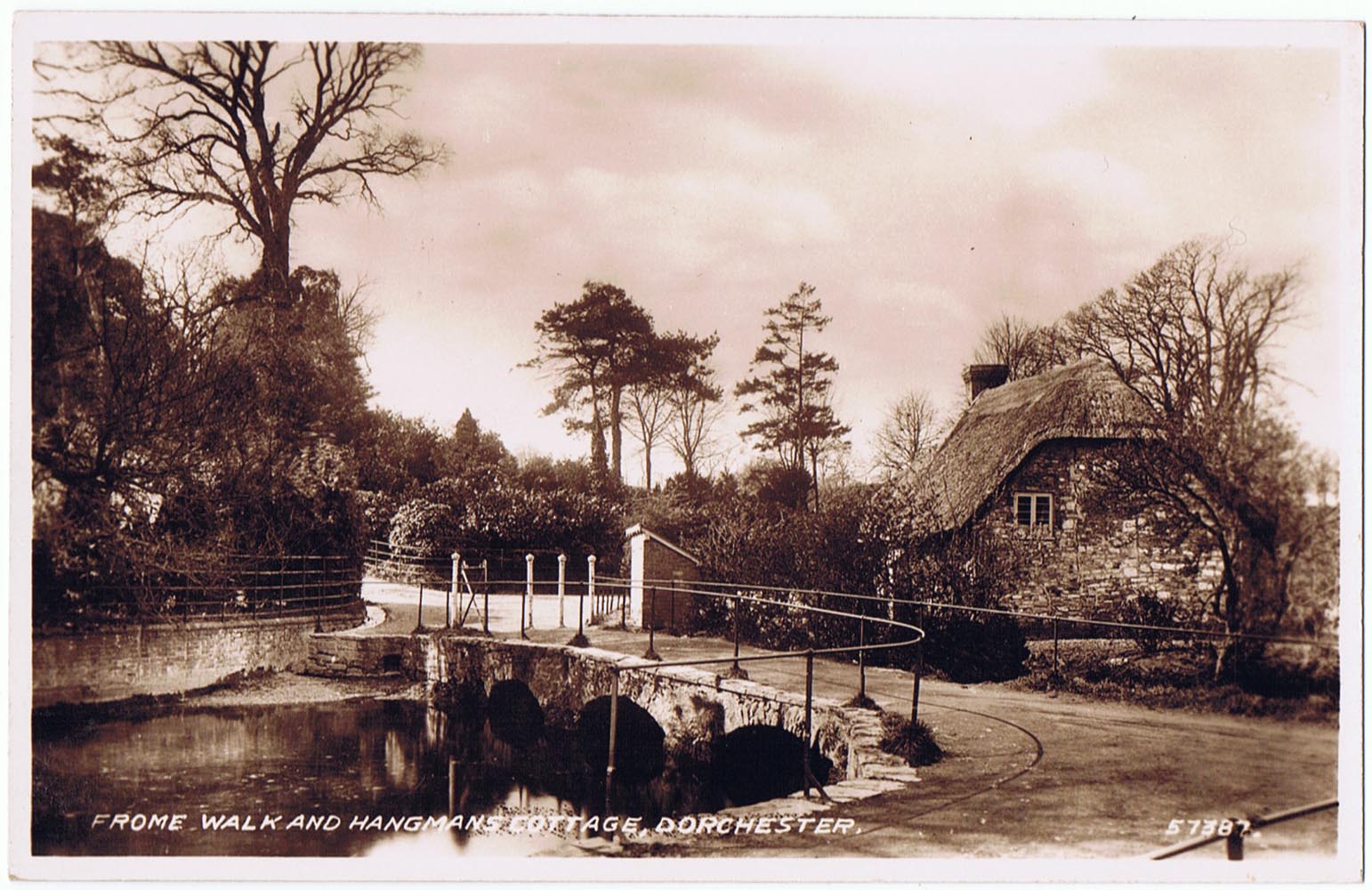
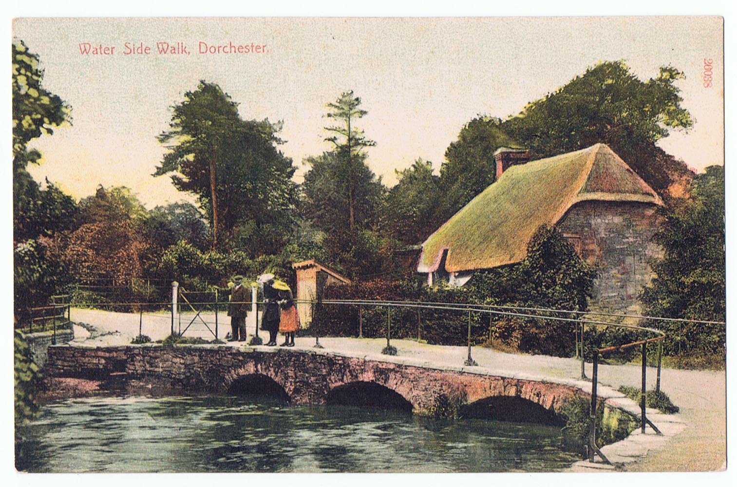
In the 18th century the walls were no longer needed as defences and the top of the embankments were leveled out and lined with trees. These avenues are today referred to as "The Walks" and provide a delightful well shaded walk around two thirds of the town. At that time they still marked the boundary of the town with only a few houses outside the old walls. The Walks were mainly planted in two separate campaigns. The west wall where it extended north of the old West Gate into Dorchester was originally called 'The New Walks' but has since been renamed 'Colliton Walk'. The section of the west wall that extended south from the West Gate into Dorchester was called 'The Old Walk' but is now referred to as 'West Walks' and 'The Bowling Alley' (which turns to meet the old South gate into Dorchester).This section was laid out about 1712. The rest of the South Wall originally called 'Chestnut Walks' and now 'South Walks' together with the eastern section called 'Salisbury Walks' was laid out in 1743. The original trees were sycamores and limes (1712) and chestnuts (1743). The riverside walk completes the circuit of the town and was known as the Frome Walk, part of which is depicted in the postcards showing 'Hangman's Cottage' below. Where possible I have also provided a link to a modern day photograph of the area. The Corporation employed a 'Walks Keeper' to help maintain these rights of way but the only one that I know of was George READ who looked after them and Borough Gardens from at least 1881 until after 1911.

1. South Walks - 1922     Link to Picture 2008


'South Walks' used to be called 'Chestnut Walks' see 1771 Map of Dorchester (y)
They run from the site of the old South Gate into Dorchester, to Gallows Hill


Posted in Hampstead, London - 28th February 1922
2. West Walks - 1907     Link to Picture 2008


'West Walks' used to be called 'The Old Walks' see 1771 Map of Dorchester (x)
Image 57390 taken 1907 - Looking North to West Gate; Borough Gardens on right


Posted in Dorchester 20th August 1920

3. Borough Gardens - 1905     Link to Picture 2010

        
Posted in Dorchester 23rd December 1905

4. West Walks - 1934


'West Walks' looking south from the old 'West Gate'
Borough Gardens is over the hedge on the right - Image 209-107. J.V


Posted in Dorchester - 1st Oct 1934
5. The Grove - 1906     Link to Picture 2010


By 1901 'The Grove' ran parallel to the old Roman Wall and Colliton Walk on the right
Colliton Walk used to be called 'The New Walks' see 1771 Map of Dorchester (w)


Posted in Leigh-on-Sea, Essex - Oct 1906

6. Roman Wall 1909   Picture 2010


Remains of the Roman Wall on West Walks
Only one very small section survives today (see pictures)
7. Bowling Alley - 1903   Picture 2006


Unposted but says "Would you and I were here"
And on the back From Lizzie Oct 1903
8. Bowling Alley - c1906


Unposted - ½d stamp required - Image 26041
printed in Saxony by CF Stengel & Co Ltd London

9. Hangman's Cottage - c1908    Pictures 2008/9


Frome Walk by the river & the bridge by Hangman's Cottage
Negative 57387 approx date 1908 (winter time)
10. Hangman's Cottage c1910


Image 26038 Stengel & Co Ltd divided back so after 1907 (summer time)
trees bigger & there appears to be a building behind cottage so later date 1910?

Note:- I am still trying to obtain postcards from an early period covering Colliton Walk; North Walk and Salisbury Walk and when I have these they will be added above and linked to modern day pictures some of which I have already located below. If you have other postcards showing different scenes from Dorchester's past please make contact via the email address on the front page.

Link to current day picture of Colliton Walk second picture Colliton Walk third picture Colliton Walk

Link to current day picture of North Walk

Link to current day picture of Salisbury Walk and 2nd picture

Link to current day picture of Frome Walk

Dorchester Page     OPC Page